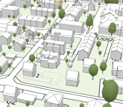
While yesterday’s post was about Open-Street-Maps (OSM), it is worth mentioning that the city of Zürich maintains its own map server, with very complete maps with very complete information about all public services, from water fountains to schools. The granularity of the information is pretty impressive: for each tree in the public space you can get the species, the year it was planted. The city also maintains a 3D viewer, which contains building shapes, as well as height and lot information. Where I found that tool really useful is that is also shows you future buildings, constructions whose plans are approved.
